Well it's been awhile since I completed a formal assignment such as the Lab 1 for GIS4043! While I have partaken in some ESRI Training, which included exercises, this is the first time working on a GIS project with a grade in mind. 😬
The bulk of this Lab was pretty much a rehash of my existing skill set with GIS from my days using ArcMap... But with that in mind, and as the orientation document suggested, many things with ArcGIS Pro look different or have different names. So getting back to the basics is not necessarily a waste of time as might be imagined.
Working through the Lab, the first step was acquiring the project data for ArcGIS Pro. I have a robust PC that I use for my daily work running AARoads.com, so for class, I choose the option of setting up ArcGIS Pro, Citrix and Google Drive locally. As far as the Lab instructions go, this resulted in a little level of confusion, as I had to keep in mind my local file folder structure versus what is on the Virtual Desktop through ArgoApps. So when checking the project save options on ArcGIS, the default location is obviously different on my PC than the S drive on the UWF server.
Acquiring the data from the R drive was simple, but having both the folder ArcGISOverview with the Data folder containing OverviewArcGIS threw me a little off when it came to zipping up the completed project file and where to place it on my S Drive.
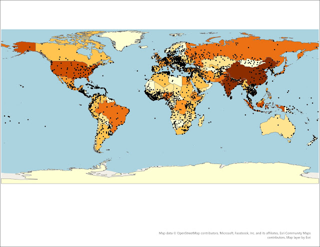
The actual work on Lab 1 involved importing some basic World Map features including polygons for countries and points for major cities. The only hang up for me working with ArcGIS Pro on this was placing the map in the Layout view. The instructions called for setting up the Layout so that no country was cut off. However my map was slightly zoomed in so that eastern Russia and western Alaska were outside the Layout view.
Watched the Overview video to see if the same scale difference occurred, and it did not. However with my prior knowledge of ArcMap, I recalled changing the Scale Properties to fit the World Map within the Layout. The Overview video also showed the map with the World Cities points reduced in size from 10 point size, so I followed suit and scaled them down on mine to 3 point size.
Spent three and half hours working through the Lab, including a helpful phone call with my wife on how to use the Activate Map Frame option within the Layout. The finished product:


No comments:
Post a Comment